As of Monday, December 26, the severe blizzard sweeping through the United States and Canada has resulted in more than 30 reported fatalities. In Canada, four individuals lost their lives in a car collision on an icy road. The storm has caused widespread disruption during a critical time for global travel and tourism, particularly in these two countries where families gather to celebrate the holiday season.
Table of Contents
What Exactly Is A Bomb Cyclone?
The snowstorm has been referred to as a “bomb cyclone” by weather forecasters since it differs from typical meteorological phenomena. Although this kind of storm is not particularly uncommon, it is highly powerful and has high winds that are dumping a lot of snow or rain in several places. A mass of low-pressure air collides with a mass of high-pressure air to create storms. Winds are produced as air moves from areas of high to low pressure.
How quickly the pressure in the low-pressure mass drops—by at least 24 millibars in a 24-hour period—defines a bomb cyclone. The gradient, or difference in pressure between the two air masses, grows swiftly as a result, strengthening the winds.
Bombogenesis is the name for this process of fast escalation, which sounds even more terrifying. The National Weather Service meteorologist and spokesperson John Moore stated in a New York Times story that the circumstances for bombogenesis should continue to move as the region where the two air masses meet travel northward and eastward.
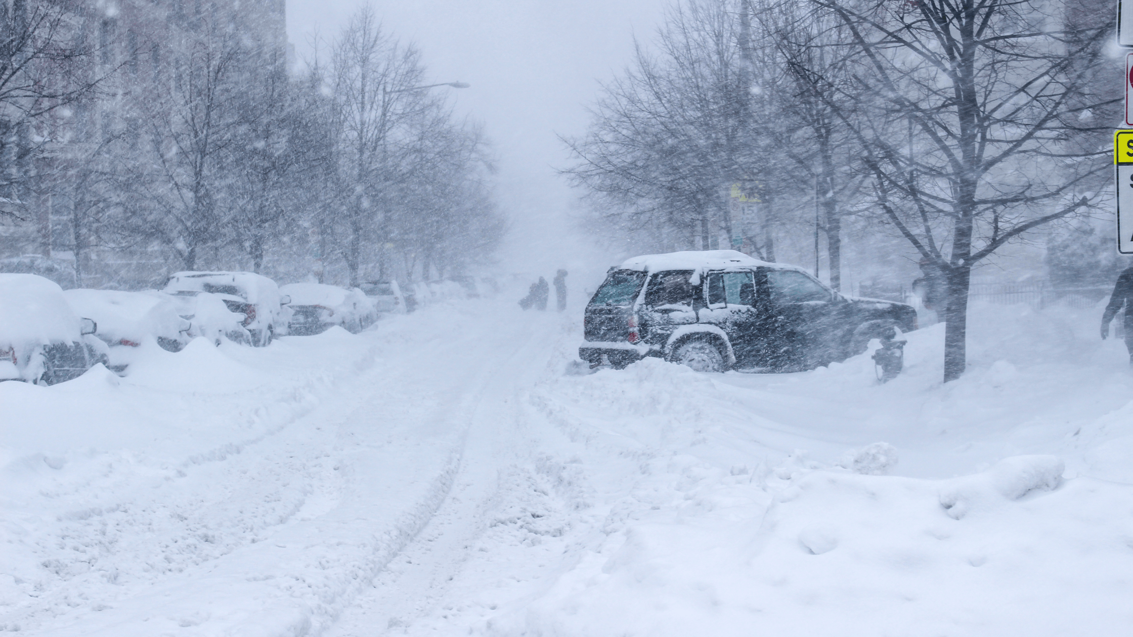
Situation In The US
The storm’s size, according to an AP report, has been almost “unprecedented,” spanning from the Rio Grande near Mexico’s border to the Great Lakes in Canada. According to the National Weather Service, temperatures plunged sharply below average in several parts of the country, and almost 60% of the US population was under some kind of winter weather alert or warning.
A blast of Arctic air will dive south and help spark a strong blizzard that will churn through the central and eastern US, NASA’s Earth Observatory had predicted on December 22.
The deadliest winter storm to hit the greater Buffalo area of New York since a blizzard that claimed nearly 30 lives in 1977, according to New York Governor Kathy Hochul, was described as a “epic, once-in-a-lifetime” weather calamity. Thousands of planes have been cancelled or delayed as of right now.
Many homes lack heat and lighting as the temperature has continued to drop. Even though power has now been restored, thousands of homes in New York are still chilly and dark. On Sunday, about 34,000 homes were still without power.
What Safety Measures Have Been Suggested Thus Far?
But as the Arctic air moves through much of the nation, it will eventually thaw and lose some of its frigidity, lowering the pressure differential and causing the storm to eventually pass. According to forecasts, the majority of the country will have above-average temperatures the next week, according to Moore. Road users will need to drive with extra caution until then since visibility will be compromised.
According to Governor Hochul, “conditions will worsen this evening as temperatures dip across the state later today. I’m advising everyone to remain off the roadways this evening. Keep warm, stay inside, and be careful this weekend. Additionally, those who are indoors have been instructed to maintain safety procedures including charging electronics and keeping flashlights ready. In addition to dressing in the proper layers, it was suggested that individuals working outside take frequent breaks to prevent exhaustion or health problems.
Also read: